AI-generated illustrationRuteng terraces & Wae Rebo
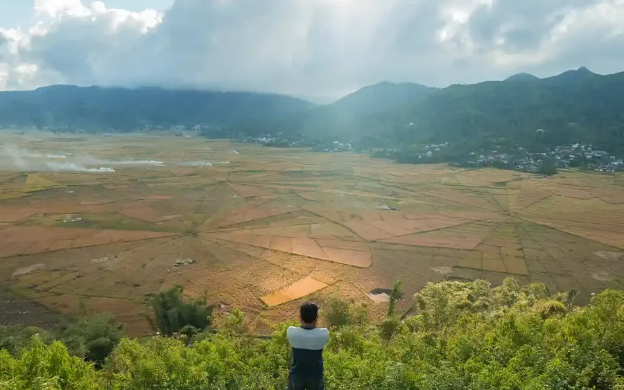
The first climb off the coast into cool highland air: Cancar’s spider-web rice fields, and the trailhead country for the Wae Rebo cone-house village.
The 532 km cross-island highway
West to east across the island — Labuan Bajo harbour, up into the Ruteng highlands, over the Bajawa volcanoes, to the Kelimutu crater lakes and down to the Maumere coast. We show the honest distance, drive-hours and altitude, not disconnected day-tour tiles.
Distances, drive-times & elevations indicative, as of 2026.
The custom feature
Pick your gateway, your days and up to two interests. The Composer returns an honest day-by-day roadbook — which towns you sleep in, the real driving segment and hours per leg, the elevation you gain or lose, and a plain honesty note if a request doesn’t fit. No live pricing, no fake availability — only real geography, as of 2026.
Eastbound suits travellers flying into Ende (ENE) closer to Kelimutu.
Choose up to two interests to slot real highlights into your days.
Your day-by-day roadbook appears here — real towns, real drive-hours, honest altitude. Pick your inputs and assemble.
The overland spine
The full west-to-east profile drawn as contour bands, with km-markers and each real segment’s drive-hours labelled inline — the honest “how far, how long” that day-tour listings tend to bury. The teal line is the road; the dashed riser above Moni is the Kelimutu summit, reached on foot at dawn.
Three highland regions, one road
The traverse climbs through three distinct highland cultures. Each plate lists the elevation, how you reach it by road, and its signature sight — as of 2026.
AI-generated illustrationThe first climb off the coast into cool highland air: Cancar’s spider-web rice fields, and the trailhead country for the Wae Rebo cone-house village.
AI-generated illustrationVolcano country under Mt Inerie: megalithic Ngada villages of Bena and Tolokela, plus the Blue Stone Beach and hot springs on the way through.
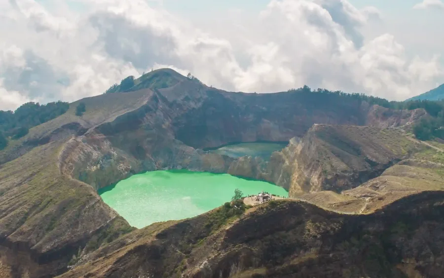
AI-generated illustrationThe climax of the traverse: three colour-shifting crater lakes best seen at dawn from the summit boardwalk, reached from the village of Moni.
Trans-Flores drive ledger
The real Trans-Flores Highway segments, as of 2026 — the honest data column the niche rarely states plainly. Altitude change is measured between town centres: the road itself tops out around Ruteng at ~1,200 m, and Kelimutu’s 1,639 m summit is a separate dawn climb from Moni (~750 m), not a point the highway crosses. Distances and drive-times are indicative and vary with road conditions.
| From → To | Distance | Driving hours | Road character | Altitude change |
|---|---|---|---|---|
| Labuan Bajo → Ruteng | 135 km | 4–5 h | Winding mountain ascent, sealed | ↑ +1,200 m |
| Ruteng → Bajawa | 130 km | 4–5 h | High ridgeline, twisting, sealed | ↓ −100 m |
| Bajawa → Ende | 120 km | 4–5 h | Descent to the south coast | ↓ −1,100 m |
| Ende → Moni | 52 km | 1.5–2 h | Short mountain climb to Moni, the Kelimutu base village | ↑ +750 m |
| Moni → Maumere | 95 km | 3–4 h | Mountain-to-north-coast descent | ↓ −750 m |
| Full west–east traverse | 532 km | 16.5–21 h | Sea level → 1,200 m at Ruteng → sea level; Moni sits at ~750 m | Net 0 m |
Drive ledger indicative, as of 2026 — actual times depend on weather, roadworks and stops.
Highland sight spec chips
One honest chip per signature site — each with its elevation and a plain access note, as of 2026.
Three colour-shifting crater lakes, best at dawn from the summit boardwalk.
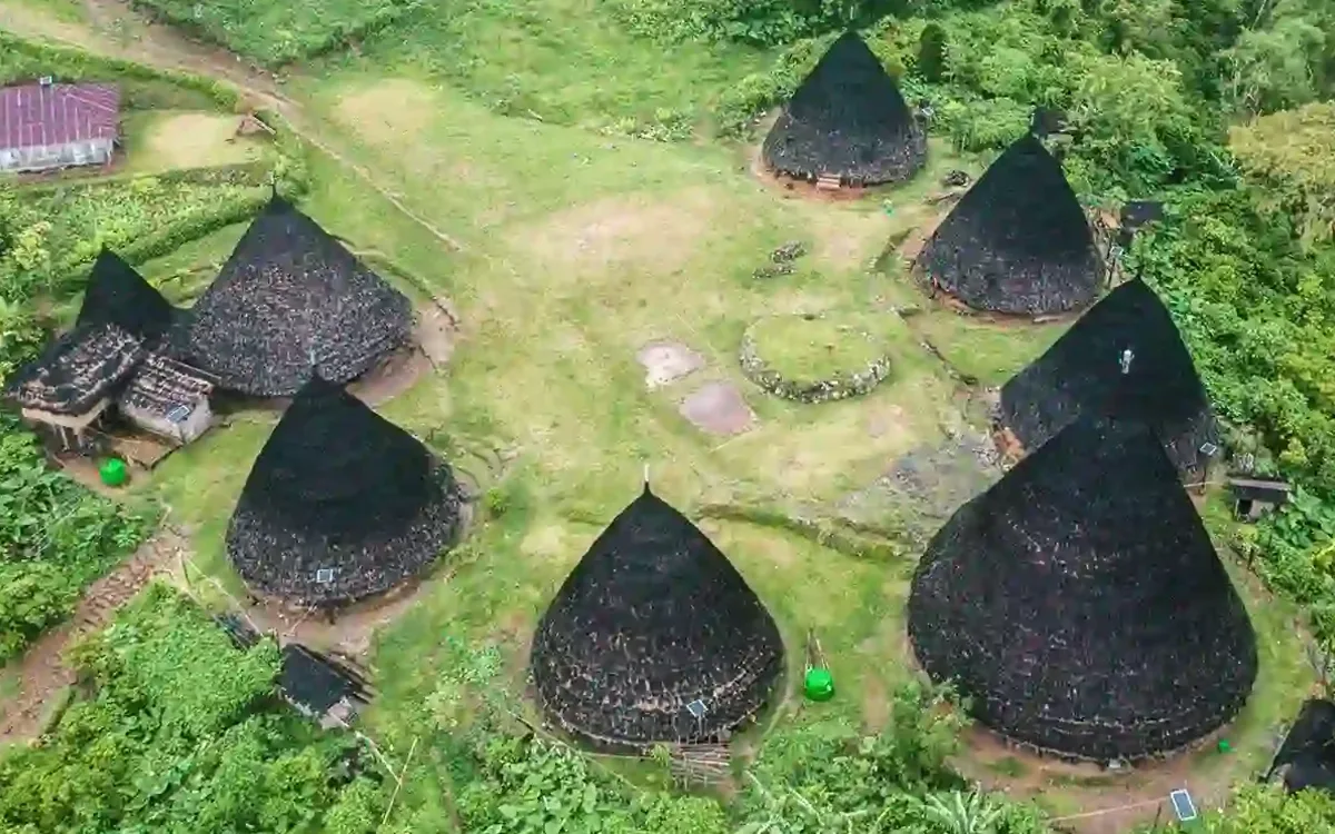
Seven conical Mbaru Niang houses; a ~3–4 h trek in with an overnight homestay.
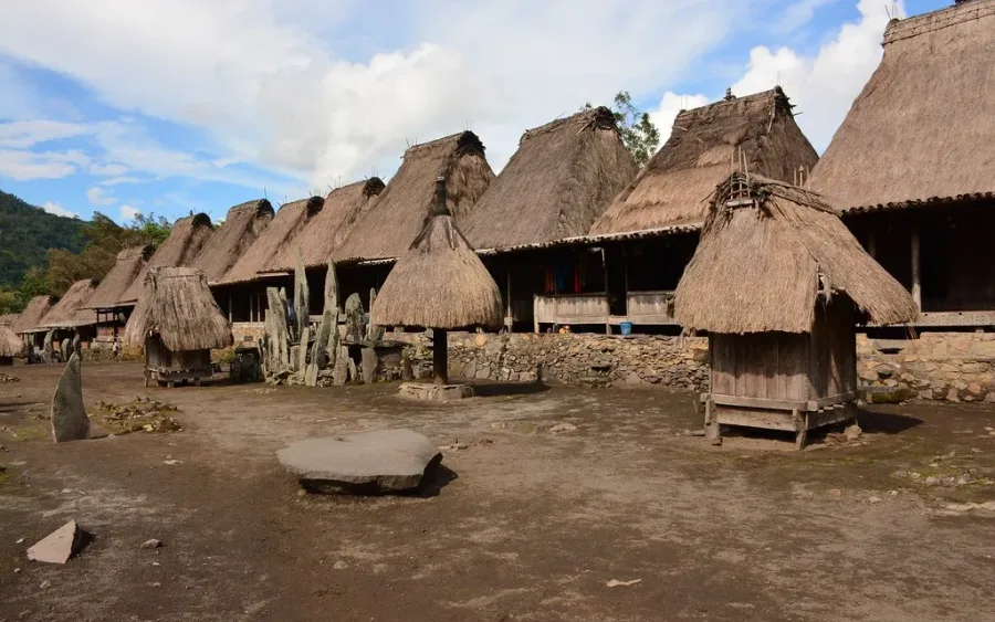
Stone-terraced Ngada village beneath Mt Inerie, west of Bajawa.
Spider-web radial rice paddies in the Manggarai highlands near Ruteng.
Backstrap-loom weaving villages on the coast near Maumere.
Season & road-condition honesty
Honest guidance for the overland traverse, as of 2026. Neither season is a sales promise; both have trade-offs.
Plan & book
Every booking and planning page, grouped so nothing is more than a click or two from here.
How overland Flores works
What a real touring day looks like, and what keeps the traverse safe and unhurried — stated plainly, as of 2026.
Your own vehicle with a local driver-guide the whole way — no shuttle-hopping between disconnected day tours.
Start at Labuan Bajo (LBJ) westbound, or fly into Ende (ENE) to begin closer to Kelimutu — the route is planned around your flights.
Driving is capped at roughly 5–6 hours, with rest and explore time built in, so mountain roads stay comfortable.
Dawn starts for Kelimutu, sensible overnight towns, and honest notes when an itinerary is too tight to enjoy.
Overland questions
Higher-intent overland questions. For the full set, see our FAQ — 135 questions answered.
About 5 days covers the full Labuan Bajo–Maumere traverse with a driving leg most days. Allow 7 days to add Kelimutu at dawn and a Wae Rebo overnight comfortably, and 10 days for a relaxed pace with villages and ikat. In 3 days you can do a meaningful section, not the whole island.
Roughly 437 km of the highway, driven over several days: Labuan Bajo→Ruteng (135 km / 4–5 h), Ruteng→Bajawa (130 km / 4–5 h), Bajawa→Ende (120 km / 4–5 h), then Ende→Moni at the Kelimutu base (52 km / 1.5–2 h). We don’t recommend doing it in one push — the roads are mountainous.
Both work. Westbound from Labuan Bajo (LBJ) suits travellers combining Komodo and the sea first. Eastbound from Ende (ENE) gets you to Kelimutu sooner if your time is short. The Roadbook Composer above plans either direction honestly.
The dry season, April to November, gives the best road conditions and clearer dawns, so better odds of seeing the lakes uncovered. The wet season (Dec–Mar) is greener but carries higher cloud and rain odds at the rim — honest, not a promise.
Yes, but it needs time. Wae Rebo is a ~3–4 hour trek from Denge with an overnight homestay. To pair it comfortably with the Kelimutu crater lakes, allow 7+ days — the Composer will flag this if you choose fewer.
Talk to Komodo Luxury
Send your dates, days and interests to Komodo Luxury — the desk replies with a real day-by-day plan and pricing. Fastest by WhatsApp.
This guide does not operate boats. Bookings are fulfilled by Komodo Luxury, and this site may earn a referral commission. No fake availability — real geography and drive-times, as of 2026.
A quick backup form if WhatsApp isn’t handy — the desk replies by email.